Welcome to a majestic natural setting – enjoyed by all who come
Harriman Springs Resort & Marina is 20-some miles northwest of Klamath
Falls on the shores of Upper Klamath Lake in Rocky Point, Oregon. At the
turn of the 20th Century the mountains surrounding Rocky Point were known
as the “Switzerland of the United States.” Early visitors from around the
world came through on their way to visit nearby Crater Lake. Harriman
Springs continues to offer an outdoor experience for the general public
as a vacation destination that has been shared by generations, for
generations. Harriman Springs is a special place to visit.

The outdoor Terrace is a special place to share special moments
The restaurant and bar opens up to the Terrace that overlooks Harriman
Creek and
nearby mountains including Mt. Harriman to the south. Boats
come and go as
birds sing and waterfowl enjoy Harriman Springs and the
adjoining Upper Klamath
National Wildlife Refuge. This is a place to
put away the smart phones and
enjoy the people you are with and the
beautiful surroundings.

Brown Dog, official greeter for Harriman Spring’s Resort and Marina
Brown Dog is one lucky dog. She lives at Harriman Springs. She is
living proof
Harriman Springs is dog friendly as well as family friendly:
grandparent
friendly, parent friendly, kid friendly, friend friendly
as well as bird friendly,
fish friendly, wildflower friendly, tree
friendly and night sky star friendly.

Harriman Springs – a magical place, a magical afternoon
As the sun goes down the stars come out and the Milky Way will dance
across the sky until first light returns and many are ready to go
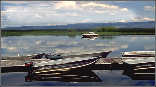
fishing. If you need a boat, Harriman Springs Resort and Marina has
you covered: 21′ pontoon boats, Craft 16′ fishing boats, Lowe’s 14′
fishing boats, 16′ row boats, and canoes. Well-maintained docks,
public boat launch, restaurant and bar all contribute to good
times at Harriman Springs Resort & Marina.

Here John Muir wrote as a guest of E. H. Harriman
This restored cabin is one of few remaining structures, along
with a couple of dock pilings, from the days when steamboats
pulled up to the docks. This may have been the cabin Muir
stayed in. The following is from a piece John Muir wrote
about his stay in Rocky Point…
“So I went to the famous Lodge, intending to stay a few days or
a week, but when I spoke of leaving, Mr. Harriman said I must
stay and work, and directed his private secretary to follow me
and put down everything I said. So I was fairly compelled to
make a beginning in dictating to a stenographer, which proved
rather awkward at first, but in a couple of months a sort of
foundation for more than one volume was laid.

Photo courtesy of Oregon Digital, University of Oregon.
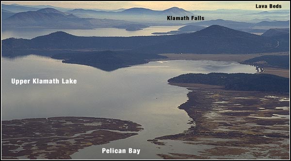
The Lodge was beautifully located at the head of Pelican Bay
beside its famous crystal springs, the magnificent Klamath Lake
in front of it, bordered with meadows and bounded in the distance
by dark forested mountains and hills –a fine place for recreation
and rest–air, water, and scenery reviving.The weather was mostly
cool and bright, just right for soothing exercise, walks in the
woods, and boating on the lake, which most of the time was mirror-
like, reflecting the sky and the fringing meadows and
forest-clad mountain shores.
On our return from boat excursions a beautiful picture
was outspread before us about an hour before sundown, especially
toward autumn, when the colors were ripening–the shining lake
enlivened with leaping trout and flocks of waterfowl; the stream
from the great springs like a river with broad brown and yellow
meadows on either hand; and the dark forested mountains, changing
to blue in the background, rising higher and higher, with Mt. Pitt,
highest of all, pointing serenely heavenward through the midst
of the sunset purple and gold.”
Some things never change. To read more of what John Muir wrote about
the life and times of his dear friend visit Edward Henry Harriman.

Sitting by the campfire sharing stories, food and drink
Camp fires are a long tradition on this land overlooking Harriman Springs
and Creek. The Gu’mbotkni, one of the Klamath Indian’s five branches,
had winter settlements on Pelican Bay and Rocky Point. Klamath or
ewkskini means” People of the Lakes.” The Klamath dug roots,
picked berries and gathered seeds of the area Water Lily, Wocus.
They trapped wildlife, hunted waterfowl, elk, deer, antelope and
bears and caught fish. Eight locations of Indian earth-lodges,
settlements and sweat lodges are scattered across Rocky Point.
Today, 8 campsites with fire rings can each accommodate two tents
and up to 8 campers. A great tradition of camp fires continues.

Harriman Springs has room for all
In days of old, folks arrived at Harriman Springs by boat, wagons and horses.
Today Harriman Springs Resort and Marina offers 8 RV spaces on
30 – 50 foot pads with water, sewer and 50 amp electrical hookups.
Harriman Springs water is the best.

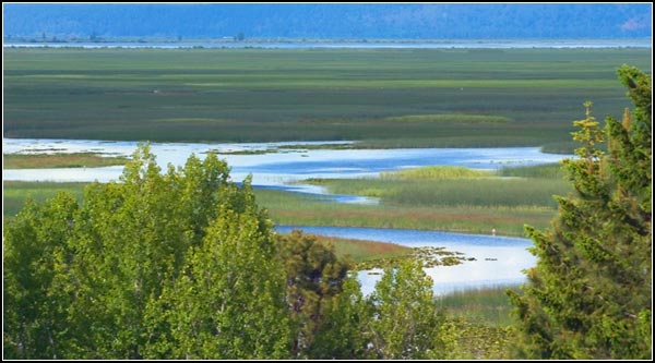
The creeks and bays of Upper Klamath National Wildlife Refuge await
Pelican Bay is a short canoe trip on Harriman Creek. Take a left at the bay and
the canoe trails of Upper Klamath National Wildlife Refuge are mere paddles
away.Become one with nature. All that you can see and hear is yours.

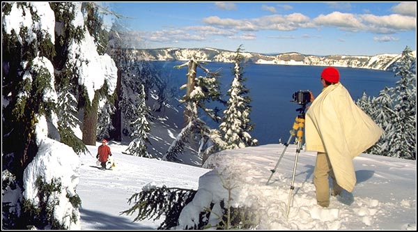
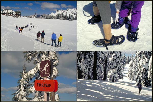
World class destinations beckon from all directions
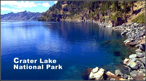
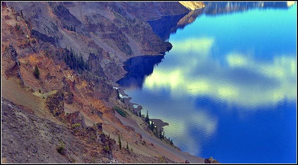
Other nearby attractions include Crater Lake National Park,
Running Y’s Arnold Palmer designed golf course, and the only all
tree-based zipline canopy tour entirely on National Forest in the United
States. Crater Lake Zipline is also Oregon’s Longest zipline.

Harriman’s – a wonderful place for a leisurely meal and drink
There is also room to find a secluded table in the restaurant or outdoor
terrace and room for large events like weddings and corporate getaways.
Interior are tastefully decorated with local history and nature artwork.

A place, if you wanted, where everyone could know your name
The bar is part of the restaurant complex. It is the local watering hole
that welcomes Harriman Springs visitors. Here at Rocky Point everyone is
in it together. “Enjoy America Again – visit the outdoors” or as
Brown Dog says “visit Harriman Springs Resort & Marina.”

After a great sleep, birds are singing and fish jumping
Sleeping at Harriman Springs is wonderful. There are three cabins
available: Cabin One is 3 bedrooms, 3 baths, full kitchen,
large common area and washer-dryer. It can sleep 10 with two
fold out sofa beds in the big room. Cabins 2 and 3 each have
king beds that sleep two in comfort. The day and night natural
sounds of trees, marsh and water are a big part of
the Harriman Springs experience.
“Herbert Fleishhacker, of the San Francisco’s Fleishhacker Zoo,
purchased the resort around 1918 and was responsible for building
four large cabins, a 10-car garage, a dining room, the Earl’s Court
(which was servant’s quarters). and a store to house his supply of
imported liquors. He also built a Dance Pavilion, which was located
near the Springs. Fleishhacker entertained many Wall Street
millionaires, including J.P. Morgan, who earlier had been stymied
by Harriman in the Union Pacific takeover. On a summer night the
walkway for the ladies in their long dresses from the dining room
to the Dance Pavilion was lit with Japanese lanterns.”
– from Katherine Sloan’s presentation to the
Klamath Historical Society, June 1989.

Sunrise! A guest is out for a walk in the woods
There is plenty of room at Harriman Springs Resort and Marina
to find space, wonderful spaces, to be alone in your thoughts
or find yourself free of thoughts. Take a deep breath of mountain
air and relax. You are here, enjoy.


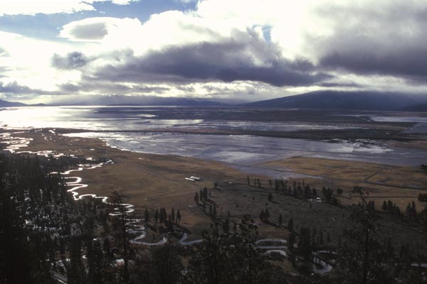
Looking northwest at Harriman Springs from Coyote Point
The Volcanic legacy All-American Road, which runs through Rocky
Point, is a beautiful collection of scenic roads connecting
Lassen National Park with Crater Lake National Park. Crater Lake
is a beautiful 40-some miles drive from Harriman Springs Resort
and Marina. Pelican Butte raises up from the shores of Rocky Point
and Fremont – Winema National Forest. This is a majestic landscape
with four dramatic seasons of outdoor adventure.

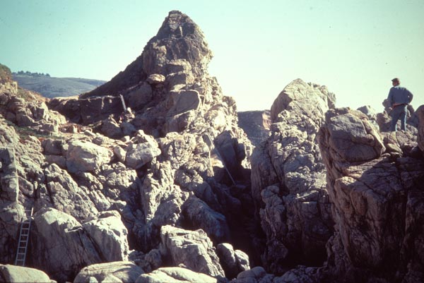
Behold a majestic outdoor wonderland
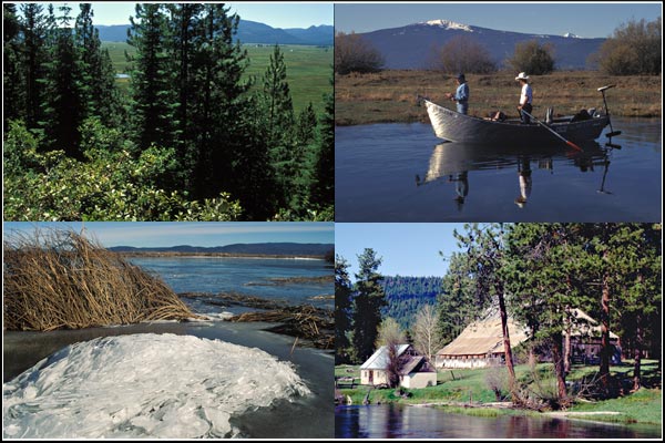
This is the view of Rocky Point from the top of Pelican Butte, 8,400 feet
above water, marshes, fields and forest. Winter is a special time on
Pelican Butte for snowmobilers. During the summer and spring, mountain
trails are there for the exploring. Mountain experiences are at the
backdoor of Harriman Springs.

Views of the old restaurant between 1996 and 1998
Harriman Springs Resort & Marina was first named the Pelican Bay Lodge,
built in 1889 by G. Grant Geary, and renamed Harriman Lodge by Edward
Harriman, the wealthy railroad tycoon, who purchased it in 1906. The
original lodge burned in 1942 and was rebuilt in 1953. Among
Harriman’s many guests was his good friend, naturalist John Muir.
Harriman Springs was closed to the public in the late 1990s and
reopened in 2014 after a lengthy restoration by owner John Pratt,
a long time Rocky Point resident and fisherman.

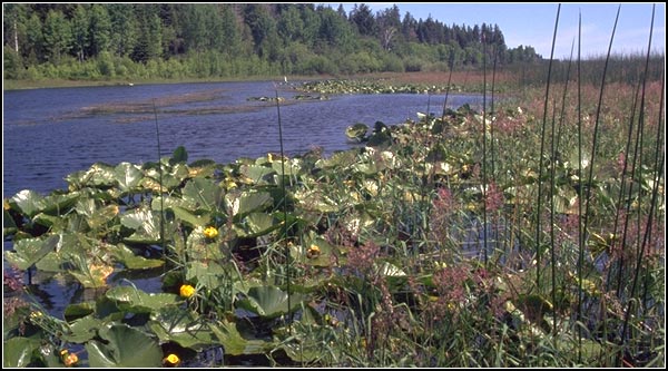
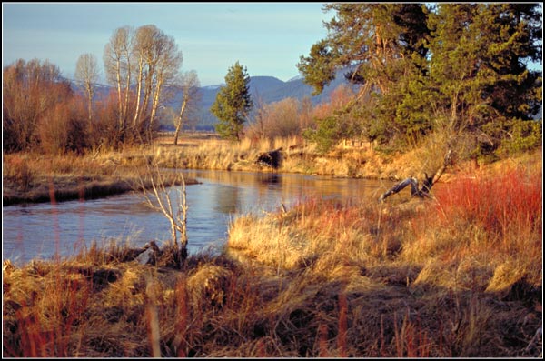
Spring fed Harriman Creek empties into Pelican Bay
Enjoy a day at the lake, hunting, fishing, bird watching, boating at
sunset or sipping wine on the deck… There’s something for everyone!

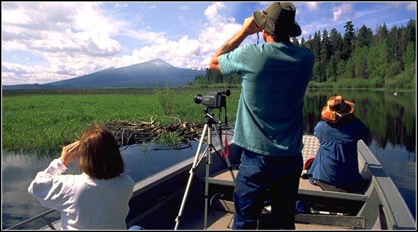
Harriman Springs is a fishing mecca from Indian days to now
Harriman Springs and Harriman Creek are part of a large interconnected
fishery that includes feeder streams and springs providing cool water
for Pelican Bay. Fish Bank near Pelican Bay’s mouth connects with the
nearly 25 mile long Upper Klamath Lake. The Wood River and Sevenmile
Creek feed into Agency Lake which connects to Upper Klamath Lake.
The Sprague River joins the Williamson River on its way to Upper
Klamath Lake. Nearby are Lake of the Woods and Fourmile Lake.
Good fishing begins in the spring and runs through the fall as the
fish move through the fishery seeking warmer and cooler waters.
In the various creeks, streams, rivers and lakes redband trout,
yellow perch, brown trout, rainbow trout, brook trout, lake trout,
and sockeye salmon are present depending on the season. It is safe
to say this is a legendary fishery. Fish on!
“So much was Mr. Harriman pleased with the Klamath Country that
he purchased a mountain home in the Pelican Bay retreat, and
later purchased the Odessa Lodge adjoining his original tract,
comprising in all one of the most beautiful hunting and fishing
grounds on the continent, and he could, and did buy the best.”
– from a brochure printed by the Klamath Development
Company and Sunset Publishing Company in the early 1900’s.

Here the Old West is alive and well
Harriman Springs Resort & Marina is surrounded by Upper Klamath
National Wildlife Refuge and working cattle ranches. Logging was once
a major part of the economy. Cowboys, hunting, fishing, firewood
gathering and mushrooming continue.
“Mrs. Fleishhacker used to come up here and spend her summers.
She would come down to our house on the creek. She smoked and of
course she couldn’t get cigarettes so Jim Straw, being an old cowboy
that he was and a cattleman, would roll those cigarettes with one hand.
He’d roll probably fifty or a hundred for her at a time.”
– Bev Wampler, Volume 6: Klamath County Historical
Society’s Trumpeter, Spring 1991.

A place to create and preserve cherished postcard memories
The first post office in the area was named Pelican; it was
established in 1888 and ran until 1907. It was followed by other
names: Recreation, Pelican Bay, Rocky Point and from 1947 to 1954
it was known as Harriman, after railroad magnate E. H. Harriman,
who died September 9, 1909 at the age of 61 in his New York bed
surrounded by family. Mt. Harriman watches over Harriman Springs
and all that he loved in Rocky Point and beyond.

Image derived from Klamath County Museum photo.
A lodge is a lodge is a lodge
The resort itself, overlooking bubbling springs, has been known
by many names over the years: first it was Kendall/Cray Resort,
followed by Kendall’s Lodge, Pelican Bay Lodge, Harriman Lodge,
Pelican Bay Lodge #2, Harriman Lodge #2, Harriman Resort and
present day Harriman Springs Resort & Marina.

Image derived from Klamath County Museum photo.
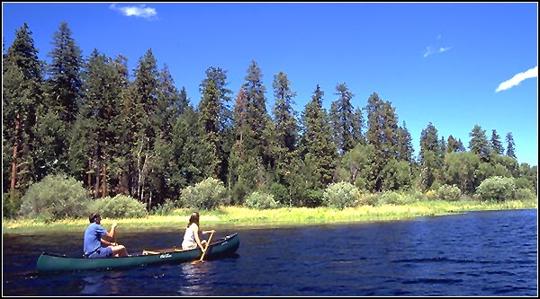
Where different worlds have come together
One constant has been boating, be it dugout Indian canoes or
triple-decker steamboats complete with military brass bands.
Out on the water experiences are the same as days of old and
hopefully the future: springs, marshes, wildlife, birds,
forests, mountains and being one within the moment.
Take a boat, fish, look, listen and time travel.

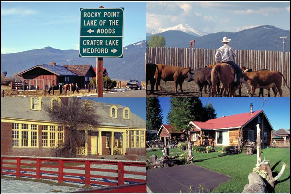
Here are other locations near Harriman Springs Resort and Marina:
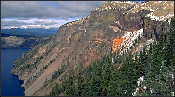
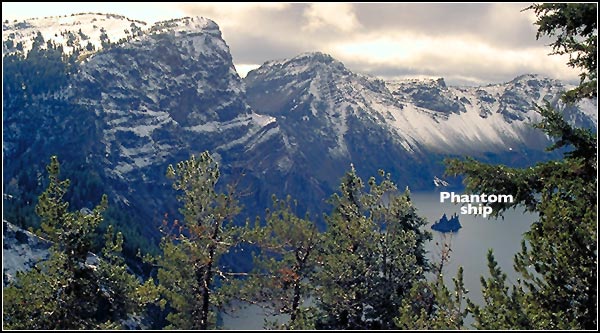
Behold the spectacular Crater Lake National Park
Visit the old west in Wood River Valley and Fort Klamath
Take a moment to relax at Mare’s Eggs Springs
Enjoy the sights and sounds of Upper Klamath National Wildlife Refuge
For nature enthusiasts see Bird Habitats of the Region
Take a video tour of the Klamath Basin National Wildlife Refuges
“Meet us at Harriman’s Springs Resort & Marina”
Of course, Brown Dog the official spokes-lady for Harrimans would
have the last word. The video above includes scenes from Brown
Dog’s recently discovered audition reel to bolster an international
talent search hunting for Brown Dog’s voiceover artist. Boats
provided by Harriman Springs Resort & Marina’s owner John Pratt
and resort guest Frank Galusha. Video by Anders Tomlinson.
Music is from “Escapades” by the Dig Brothers’ Anders Tomlinson
and Denver Clay. The day was June 28, 2017 and it was a mighty
fine day to be in Rocky Point. Everyone had a good time.
©2017 Anders Tomlinson, all rights reserved.
All photos by Anders Tomlinson unless noted.
Anders would like to thank Frank Galusha, Sharon Waranius,
John Pratt, Brown Dog, staff at Harriman Springs Resort & Marina,
Bill and LoEtta Cadman and Denver Clay for their assistance
with this page. Everyday is history.