Confluence and Influence.

We Have Come so Far, One Wonders, How Far We Can Go?

The Klamath River Watershed is a convoluted landscape shaped by colliding tectonic plates, fire and ice. For Modern Man, it is ripe with political dilemmas, survival needs and ethical nightmares.

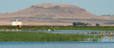
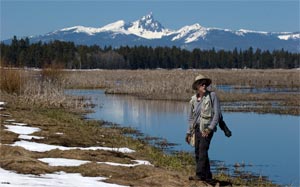
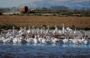
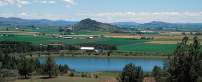
Clockwise: Klamath Marsh Refuge, Crooked Creek, Iron Gate Dam, Klamath River Estuary, Sugar Loaf Mtn - Ishi Pishi Falls and rafting on Upper Klamath River.

Anders Tomlinson spent 13 years looking, listening, filming and recording in the Klamath River Watershed. He had several watershed moments including the day he read in the newspaper that Sacramento River interests were fighting Trinity River interests over water to protect environmentally endangered salmon in both the Sacramento and Trinity Rivers. Both sides had federal lawyers facing off against each other in court. What does one do? What do we do?  

It Is Helpful To Know Where We Came From to Understand Where We Are..

Trinity River is Klamath River's largest tributary and important salmon habitat.

The first European miners-settlers, traveling from the mouth up the Klamath River enroute to build a mining settlement, which is now Happy Camp, thought the Trinity River was the main-stem and the Klamath River was a tributary. The underwater canyon that is carved in the ocean bottom off Klamath California was named Trinity Canyon not Klamath Canyon. The miners promptly set the forests on fire.  It was the easiest way to reach bare ground in a land of steep canyon walls.  When the winds were right the smoke choked Portland.  Nautical maps made note of smoke off the coast as a navigational hazard. That was then.

Today, there is a need to rethink our ideology on a host of issues including those considered politically correct or untouchable. Here is an opportunity to refocus man’s relationship in, not to, nature. Food, water and shelter are in jeopardy for all stake-holders and species. Welcome to the age of Anthropocene. Welcome to the Klamath River Watershed. This is now. For geographical and historic background visit Klamath River Watershed in pictures and words.

Watersheds are for flora and fauna. Watersheds change over time.

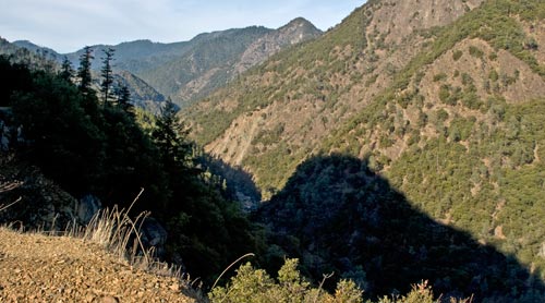
Mountain shadow and the Trinity River, photo by Anders Tomlinson.

This is what the Klamath River Watershed looks like. Where's the Basin?

The Klamath River Watershed, see video, is clearly defined. Waters flow downhill to creeks, streams and rivers that flow to the Klamath and Trinity rivers, which join some 40 miles from the Pacific Ocean, and empties into the sea. This is exact – no room for interpretation.  It is a place with absolute boundaries. Water flows this way or that way.  The Klamath Basin is a headline that means different things at different times to different folks. As example: in a judge’s decision that returned water management to the flows required by Hardy phase 2 she described the Klamath Basin as being the land that makes up the Klamath Reclamation Project and later on in the decision as being all the lands that are coho habitat.  Two different worlds.  If a judge is confused about where is where what can we expect from the general public or public servants?

George Lewis interviews Upper Klamath Reclamation Project farmer Ty Kliewer during the summer of 2001.  Photo by Anders Tomlinson.

NBC's George Lewis interviews Ty Kliewer during the summer of 2001.


In 2001, several young farmers interviewed by national media kept trying to say the salmon issue was about a much larger watershed – not just the twenty some miles that makes up the Klamath Reclamation Project. The media would not listen. European media did listen and reported as such.  The National Academy of Science, 12 good scientists from around the country who spent three years studying the 2001 salmon-water shutoff, determined it was not a Klamath Basin problem – it was a Klamath River Watershed problem.  Few listened.

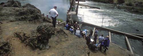
National Academy of Science at Chiloquin Dam, 2003. Photo by Anders Tomlinson.

A stop on 2003 NAS tour, the Chiloquin Dam, now removed, which blocked sucker habitat.

In the Klamath River Watershed there is little flat space. Where there is flat space with water running through it there are people, and there are few people living in the Klamath River watershed. The largest population is concentrated around Upper Klamath Lake in the Upper Klamath Basin where the Klamath River begins its 263 mile journey.

We Huddle in the Future’s Shade Waiting for Light.

bus tour of Klamath reclamation project for Klamath Indians sponsored by Klamath Waterusers Association.  Photo by Anders Tomlinson

2005 tour of Klamath Reclamation Project for Klamath Indians.

The Klamath Water Users Association presented a series of tours from 2001 through 2008 to introduce Klamath River Watershed stake-holders to the Klamath Reclamation Project. Anders documented two National Academy of Science panel tours, along with Pacific Ocean fishermen, News media, Klamath Indian Tribe and Upper Klamath Basin resident tours. All present had much in common. They are humans capable of doing “good” things and “bad” things in pursuit of their needs and expectations.

Lower Klamath National Wildlife Refuge Centennial Celebration, August 8th, 2008.  Photo by Anders Tomlinson..

Lower Klamath National Wildlife Refuge Centennial Celebration, 8-8-08.

The Centennial Celebration ended Anders’ shooting in the Klamath River Watershed.
Things had changed. The 114th Federal study of Upper Klamath Lake determined cattle should be kept away from streams and springs. Anders photographed in July 1995 cows wading across the Wood River that empties into Upper Klamath Lake. Access is now fenced off. Much has changed and much has stayed the same, it is the way humans do human things.

There are behaviors, relationships and synergies to celebrate. There are voices and concepts to listen to and consider. Polarization, ethnicity, projections, anticipations and fear of change shout louder, and have a larger audience, than seeking, understanding, embracing and compromise. It is here that these films of the Klamath River Watershed begin.

Anders Tomlinson walking in a forest near the klamath River in Oregon.  Photo by Jeff Ritter.

All water flows downhill, without the aid of man, uphill is another story.

These are stories of human nature reconciling itself with human nature.

©2011 Anders Tomlinson

A Story of Balance

Life on the Refuge

The Klamath Basin National Wildlife Complex includes six diverse refuges that encompass over 200,000 acres. They straddle the California – Oregon border. Here, seven habitats offer food and sanctuary to over 450 species. This is an important stop along the Pacific Flyway.

Swans spending the winter on Lower Klamath National Wildlife Refuge.
photo-Anders Tomlinson

Lower Klamath National Wildlife Refuge, founded in 1908, was the nation’s first waterfowl refuge.
It was followed by five others: Tule Lake, Clear Lake, Upper Klamath, Klamath Marsh and
Bear Valley. Each serves a purpose. Connected, they are a complex refuge of services and needs.

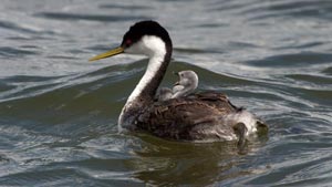
Western grebe and baby move towards the future.
photo-Anders Tomlinson

There are summer days with bodies of water, large and small, shallow and deep, moving and still. Waterfowl, many of each, eat and rest, floating or standing. There are windy winter days when wildlife huddle in a frozen world, food is scarce and eagles eat the weak. In spring, man plants his crops and skies fill with north bound waterfowl. For many this is their last chance for food before reaching their arctic breeding grounds. Fall offers refuge to all heading south as man’s harvest comes to an end. This is home to resident mammals, fish, amphibians and birds seasonally migrating across the refuges.

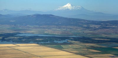
Looking at Lower Klamath National Wildlife Refuge and Mt. Shasta.
photo-Anders Tomlinson

This is life on the refuges. Nature does what it does and everything else adapts or disappears. It is what it is. Mountains surround a vast parade of shifting life. And there are storms. And there are moments of absolute tranquility. This is what my cameras have captured. This is what I have seen and heard. This is what I want to share with the world, a micro-cosmos of life on planet earth.

Walking Wetlands

A two year old wetland once was, and will become, a farm field.
photo-Anders Tomlinson

Land for farming and wildlife refuge continue to be reduced by urbanization. “Walking Wetlands” on Tule Lake and Lower Klamath National Refuges documents a successful program that incorporates the two on a rotational basis. Farm land and refuge become one, a timely recipe for success. The concept is simple. Take farm fields out of production. Build containment and connecting water structures. Flood the fields. Let them grow, managing and mimicking nature’s way, into marshes Do so for three years. Drain and allow entry and exit for farmers and their equipment. Farmers remove the overgrown tules, not an easy chore, turn the soil and plant crops. There is no need to add fertilizers or weed killers, flooding did that work. Magnificent crops grow in reclaimed marshes. Farm until the soil loses it’s nutrients and pesticides are needed. Repeat the process. Flood, water manage and return to agriculture. At all times, wildlife find values in both the marshes and farm fields. Yes, it is a simple process. And yes, it is a complex interaction of various species and ways of life. And yes, it works.

Reflecting

Pelicans, seen throughout the summer, and grebes rest and feed on Tule Lake.
photo-Anders Tomlinson

We have so much to learn from nature. My greatest insights have come from field observations. These diverse refuges have taken me to many places in many times. Each of the refuges has a dominant feature that no other has. And each of the refuges share common features. Time is measured in seasons and epochs. These refuges are sustainable existence. Here, the little picture is the big picture. I have had the privilege of knowing these refuges for years after year after year. My greatest moments have been those where I blended into the landscape and became a simple component in a grand movement. A Year in the Life on the Refuges from tule-lake.com.

©2010 Anders Tomlinson, all rights reserved.

Tulelake- Intersection of Nature

Homesteading

Tulelake is the southern end of the Klamath Reclamation Project.
photos-Bureau of Reclamation and Anders Tomlinson

The United States in 1900 needed to expand and open new settlements for it’s growing population. It was truly time to go west. The concept was to dam and redirect river water to areas that could grow food and start towns. The harnessed water would also create much needed power. The southwest would become the new population frontier and resulting economic bonanza. Opening the southwest also opened opportunities for European emigrants to start new lives. Reclamation had global implications.

Here, in the Upper Klamath Basin there was water, a key element for settlement. In fact, there was an excess of water that had to be drained.
And so it was that Tule Lake and Lower Klamath Lakes became fertile farm land controlled
by diversions. Czech settlers migrated to farm. Lucky World War I and II veterans,
lottery winners, were invited to homestead. The Klamath Reclamation Project was successful.
Engineers were able to move, or remove, water, where and when needed. Upper Klamath Basin could support a larger human population. Settlement of the west had begun.

Tule Lake Basin in early summer, made green by the hand of man.
photo-Anders Tomlinson

Headline Makers

Tulelake Homesteaders were on the cover of Life Magazine in 1946. Articles on the
Japanese-American Segregation camp were in Life Magazine during World War II.
In 2001, Klamath Reclamation Project water shutoff made evening news across the nation
and the world. The last Indian War in California, and the first to be reported internationally,
was the Modoc Indian War fought in what is now the Lava Beds National Monument.
The Applegate Trail and Lassen Trail traveled through Tule Lake basin with eastern settlers
headed north and south. Earlier, tribes crisscrossed the basin.
This is an intersection of human nature.

We Learn from our Past

Reclamation brought farming and Tulelake to Tule Lake Basin.
photos-Anders Tomlinson
The Tulelake documentary provides an opportunity to witness migration. A film trilogy is underway. One, the spring waterfowl migration. Two, reclamation of the west. Three, the forced migration of Japanese-Americans. Other historic migrations include Native Americans, Czech settlers and the Hispanic influx. There is also an undertone of federal agency migration.
The rifts and faults of the land and the building and collapsing of mountains,
are also reminders that land forms themselves are migrating.

©2010 Anders Tomlinson, all rights reserved.

A Year in the Life from Crater Lake to the Lava Beds

Visitors from Sweden enjoy Crater Lake's majesty.
photo-Anders Tomlinson
In Search of Majesty… a remarkable landscape

Upper Klamath Basin was once a large lake, Ancient Lake Modoc.
Today, the basin is enclosed to the west by the Southern Cascades,
Crater Lake- Mt. Mazama to the north, towering fault blocks to the east
and Medicine Lake Highlands to the south. Here are six National Wildlife Refuges,
Crater Lake National Park, Lava Beds National Monument, Modoc National Forest,
Winema National Forest, Mountain Lakes Wilderness Area and Sky Lakes
Wilderness Area. Several State and County parks and six history
museums dot the Basin. And there is water in all its many splendid forms.

Upper Klamath Lake as seen from a Running Y Ranch Resort ridge line.
photo-Anders Tomlinson

This is a land of four seasons. 30 to 50 degree temperature changes in a day
are common. Above the sagebrush, juniper, ponderosa, lodge pole, marsh,
lakes and rivers are moving skies that inspire one’s imagination.

History is here, protected by proud people. Geology is well represented by
evidence of many natural forces in action. This is a land of fire that has seen
flooding and drought numerous of times. It is not an easy place to live.
All must prepare for winter and a spring that can be harsh and seemingly unending.

Sparkling springs bubble up with cold clear water that turn into immediate creeks
and rivers. Migrating waterfowl find sanctuary and food here in the spring and fall.
One can learn much of the selfless effort required to raise young by watching the
wildlife care for there own during the summer and fall. It is not easy. Everything
has to be working together to make life sustainable. There have been times when
this wasn’t the case and wildlife, in all it’s splendid forms, left in search of survival.

Petroglyph Point in the Lava Beds.
photo-Anders Tomlinson

There are many reason this film should be seen?

The Upper Klamath Basin is a microcosms of planet earth. Shield volcanos
of Hawaii are mirrored by Medicine Lake Highlands. Water features from across
the world are here. Desert, seasonal and permanent marsh, forests, alpine features,
the earth is alive and growing with stratovolcanos and towering fault blocks.
And here, man has made his mark. Human settlers have been coming through here for
12,000 years. This area gives one opportunities that few places offer.
Here, is a story of an ever changing earth. And here is a reflection of man.

Anders on Klamath Marsh National Wildlife Refuge.
photo-Jeff Ritter

Producer – Director: dedication, discipline and desire.

Anders Tomlinson spent 12 years filming the Upper Klamath Basin. Projects included
films for Oregon Institute of Technology, Running Y Ranch, University
of California, U.S. Fish and Wildlife, Klamath Chamber of Commerce, Volcanic
Legacy All American Road, Oregon Governor’s Conference on Tourism,
Klamath Water Users and the California Waterfowl Association.
All of these films blend nature audio with music. Several musicians, song writers
and composers have visited me over the many years of this project. Their work
is the backbone to all my films.

©2010 Anders Tomlinson, all rights reserved.

Tulelake: Farming and Refuge working together.

Millions of visitors come each year to a land of harvests and growing families.

Tulelake, Tule Lake, Tule Lake Basin… you say potato, I say grebe, you say coyote, I say horseradish, you say harriers, i say cattle, you say pelicans, I say grain, you say mint, I say osprey, you say antelope, I say alfalfa and on and on and on… here is the nature of reclaimed lake bed used by farmers, wildlife and nature watchers. This land is alive in many more ways than controversial media sound bites and headlines you may have seen and heard.

Pelicans rest on the bank of a flooded field as farm equipment passes by. photo-Anders Tomlinson

Delivering water to soil that was once a lake bed.

Tule Lake Basin is crisscrossed by Tulelake Irrigation District’s 600 miles of canals- that’s 1,200 miles of shoreline. Water is moved back and forth from farm fields to drains, back to farms, or the lake or U.S. Fish and Wildlife projects. Today, the amount of water used in a year could be less than what naturally evaporated from old Tule Lake. Seasons dance under passing clouds and deep blue skies. A Year in the Life through photos and words.

Around the year, if there is water in irrigation canals there is wildlife.
photo-AndersTomlinson

A modern relationship between man and migrating waterfowl.

I have had people tell me that other people have told them that Tule Lake National Wildlife Refuge is too geometric with all the rectangular farm fields. Everywhere there are right angles, so unnatural for wildlife. I laugh. I wonder where those people live. The chances are their homes were built on land that was once wildlife habitat. It is also possible the land was graded and plated into grids. And in Southern California the lush landscaping, fueled by borrowed water, strived to break up the squares. How can these folks look at wildlife thriving in Tule Lake Basin and say their Tule lifestyle is unbecoming?

Wildlife takes advantage of everything it is aware of. It has been said what is good for the goose is good for the gander. Can it be said what is good for man is good for geese? Or what is good for geese is good for man? There are few habitats left that migrating waterfowl can use. Places like Tulelake are all that these migrations have. Wildlife use Tulelake refuge and farmland to survive.

Looking south from hills behind Merrill and Malin, Oregon.
photo-Anders Tomlinson
Mother nature does what she does.

The springs of 2007 and 2008 in the Upper Klamath Basin were wet. Relatively undeveloped refuge such as Upper Klamath Lake and Klamath Marsh National Wildlife Refuges had so much water there was no where for birds to put nests. Nests were being built on canal fed Tule and Lower National Wildlife Refuges. Man’s ability to manage water levels provided wildlife with safe nesting areas. Free flowing nature can be a killer, as well as a provider. Despite man’s researched predictions, whatever the research intentions may be, the world doesn’t always follow projected mathematical models. The story of Tulelake is both ancient and modern. It is a story of accommodation and cooperation. One needs to visit, linger, listen and watch with willing and open eyes. The future of man and wildlife plays out before you.

©2010 Anders Tomlinson, all rights reserved.

Tule Lake Internment Camp

During World War II, 120,000 Japanese-Americans were incarcerated in Federal relocation centers: one out of four spent time at Tule Lake.

Tule Lake Internment covered much of ground seen here including the town of Newell.
photo-Anders Tomlinson
Designed to hold 10,000 internees within a square mile Tule Lake began construction in April 1942. One month later, internees began arriving from Northern California, Washington and Oregon. Confinement peaked at 18,789. Nearly 30,000 were imprisoned at Tule Lake which remained open until 1946, the last Federal relocation center to close.

Tule Lake Internment Camp was the largest and most infamous because in July 1943 it became Tule Lake Segregation Center. Internees from other relocation centers who refused to sign a loyalty oath or caused disturbances were sent to Tule Lake.

An American Story that should never be forgotten.
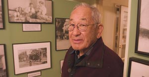
Hiroshi Kashiwagi shares his poem a Meeting In Tule Lake.
Hiroshi’s life is a great American story. His days in the Tule Lake Interment – Segregation Camp are one of many chapters: poet, playwright, memoirist, librarian, student, civil rights advocate, actor, son, husband, father…
His narration for this film was recorded in 2006 by Anders Tomlinson at Hiroshi’s San Francisco basement with Jimi Yamaichi assisting. Anders Tomlinson edited the archival still images and his Pilgrimage video footage with Hiroshi’s powerful reading and Denver Clay’s piano music, recorded in Tulelake, CA. Produced by Anders Tomlinson, Hiroshi Kashiwagi and Jimi Yamaichi. ©2012 Hiroshi Kashiwagi and Anders Tomlinson, all rights reserved. Special thanks to the Tule Lake Committee for their support and encouragement.
To watch more Tule Lake Internment – Segregation Center videos by Jimi Yamaichi and Anders Tomlinson visit My Face Was My Crime .

Modern times
In 2006, 43 acres were designated a National Historic Landmark. Some haunting reminders- a concrete jail house, leaning-tar-papered barracks, bathroom floors, sewage tanks, guard towers and barb wire fencing. Today, there are pilgrimages, film crews, federal caretakers and fading recollections.

In December 2008, Tule Lake became WWII Valor in the Pacific National Monument, Tule Lake Unit. Including Tule Lake in our National Park System will help ensure preservation of the site for future generations to learn first-hand from the lessons of this grave injustice.

Pilgrimages are held that spend several days in Tulelake and Klamath Falls.
photo-Anders Tomlinson.

Jimi Yamaichi spent a great deal of time over six years helping me interview internees. My first day with Jimi was filming a tour of the former internment center’s grounds. One of the many interviews Jimi arranged was with Hiroshi Kashiwagi. Several sessions later Hiroshi performed a spirited reading of his poem A Meeting in Tule Lake. This narration was used for an eight minute film. Three pilgrimages were also documented. For more internment information visit Tule Lake Internment Camp videos.

Jimi at the Japanese American Museum of San Jose.
photo-Anders Tomlinson

©2010 Anders Tomlinson, all rights reserved.

Fields of Splendor

The spring waterfowl migration to Tulelake-Klamath Falls is a sight to behold. Millions have enacted this yearly passage for thousands of years. Fields Of Splendor follows the spring migration from early February through late May. It also visits arctic breeding grounds and California wintering spots including Sacramento and Sonny Bono National Wildlife Refuges. Common denominators are bodies of water surrounded by farmland.
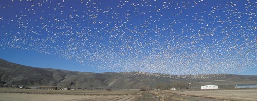
Snow geese rise off a farm field near Tule Lake National Wildlife Refuge.
photo-Anders Tomlinson

Watching a lake surface, or farm field, explode with a riotous rising of thousands of geese can take one’s breath away. One becomes part of the excitement as the geese circle overhead. How, and why, do they do what they do? Fields of Splendor makes sense of the coming and goings of Snow, Speckled and Canadian geese finding food and refuge on Tule Lake and Lower Klamath National Wildlife Refuges and Tulelake farmland. Spring Migration video.

The script for Fields of Splendor was written by Dr. Lawrence Powers. Soundtrack is by SonicAtomics. Editing will begin in the Fall or 2012.

©2010 Anders Tomlinson, all rights reserved.

Tulelake: Crossroads in History

Tulelake, California, just south of the Oregon border, was greatly impacted by the 2001 water shutoff. For numerous small family farms it was an unexpected end to a honorable way of life. Like all farmers, they had little security other than their faith that tomorrow would be a better day. And then the water was shut off…

Generation after generation raises our food and fiber.

Robert Ganey singing about living in the fields of America. Video shot in the farm land and Tule Lake National Wildlife Refuge surrounding Tulelake, California.

Under twenty feet of water…

Anders shooting southwest at Medicine Lake, Mt. Shasta and Tule Lake Basin.
Photo-Rob Crawford

A hundred years ago Tule Lake advanced and receded across the Tule Lake Basin. At that time, the current town of Tulelake was under twenty-some feet of water in the spring.
Much of the lake was a shallow evaporation pond. All of the Upper Klamath Basin, of which the Tule Lake Basin is part, is in the rain shadow of the Cascade Mountains. Throughout history, there have been wet periods and dry periods. Tule Lake would fluctuate accordingly. Today, the watershed above Iron Gate Dam comprises 38% of the Klamath River Watershed and provides 12% of the water, in a wet year.
For more geographical information visit Klamath River Watershed .

Looking at present day Tule Lake from Sheepy Ridge. photo-Anders Tomlinson

This is the northwest corner of the Great Basin. The Lost River began six miles east of Tulelake and traveled some 90 miles in a meandering circle north, west and south before draining into Tule Lake, not the Pacific Ocean. Today, a diversion canal sends much of the Lost River directly to the Klamath River.

The reclaimed lake bed, enriched with thousands of years of waterfowl migrations, has some of the planet’s richest soil. In an era of farmland constantly being taken out of production it is easy to make a case for good soil becoming endangered. This flies in the face of a concept that the next 50 years will require as much food to be raised as was grown in the past 10,000 years. Tulelake Irrigation District receives the vast majority of its water from the Klamath Reclamation Project. The district also has wells that were drilled during the 2001 water shutoff. A few farmers also dug wells.

Klamath Reclamation Project was the second effort, following Imperial Valley in Southern California, that proposed diverting water to promote developing the arid southwest. The Federal Government’s recent success building the Panama Canal provided tools, experience and brain power to rechannel rivers, build power dams, irrigate deserts and drain lakes into productive farmland. If people were to settle these developing lands they would need food and jobs. Farming offered both. For more information visit Klamath Reclamation history.

Farming and Refuge co-existing in Tulelake, California.
photo-Anders Tomlinson

Today, farming is looked at by many as a problem to be eradicated as if it were an infestation. These are the very same people who need food and water to exist. For those in the urban Southwest who want farming ended to save species there is another alternative, leave the southwest and reduce the demand on resources that many species need. Go somewhere that can support a human population along with the wildlife. This sounds extreme, but, reality is reality and human nature is human nature. Power and water demands need to subside in population centers. Each purchase or activity has multiple consequences, many unintended. Sitting in living rooms and writing checks for political movements and special interests doesn’t remove pressures created by cities which effect wildlife hundreds of miles away. As example, salmon are more impacted by urbanization than anything happening in rural America. Places like Tulelake do more per capita to help wildlife, and humans, than any Southwest city. Places like Tulelake export and provide. Places like San Francisco, Los Angeles and Phoenix import and receive. The story of Tulelake, truly a crossroads in history, is worth telling.
FFA, teaching the next generation how to provide.

Projects that have been shot in the Tule Lake Basin include Homesteading in a Promised Land, Fields of Splendor , Farmland , Walking Wetlands, Stepping Stones, Efficient Irrigation,
My Face Was My Crime, A Year in the Life and many others.
This is an American story of success told by the strong people who make their living off the land in a frontier setting.

©2010 Anders Tomlinson, all rights reserved.

Tulelake: A Graphic Rest Stop

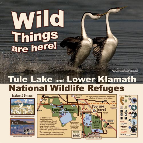
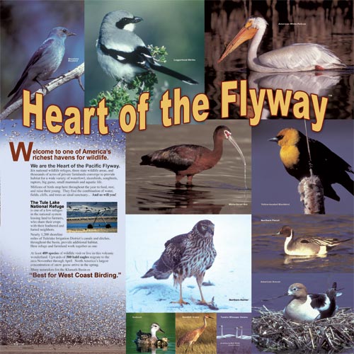
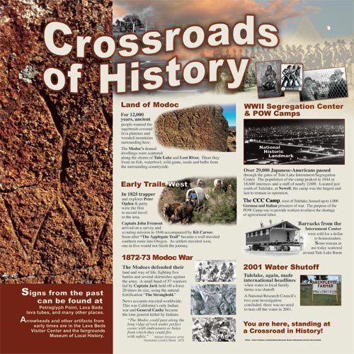
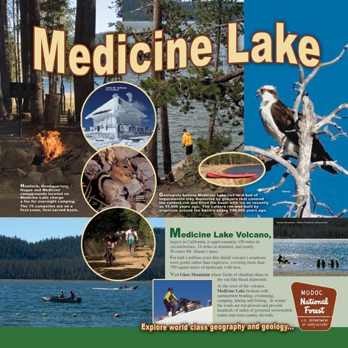
In 2008 Anders designed eight square panels, each 48 inches tall, for a community rest stop at the intersection of Highway 139, and Main Street in Tulelake. It clearly showcases places and things one can enjoy if they leave the highway and explore the surrounding landscape.

Here is California's beginning or end depending on the direction one is driving.

All of this within 39 miles from this rest stop

The adventure begins as history comes alive off the beaten path.

Visit the largest concentration of bald eagles in the lower 48 states

These are the first waterfowl refuge and a wildlife - agricultural oasis.

Many naturalists list the Klamath Basin as “Best for West Coast Birding”

At least 489 species of wildlife visit or live in this volcanic wonderland.

A magical place, well worth visiting any time of year

Explore North America's greatest concentration of lava tube caves.

You are here, standing at a Crossroad in History!

For 12,000 years humans have roam this land.

This is the second Reclamation Project as the USA looked to expanding west

In the beginning the challenge was removing water.

Some of the first steps to land on the moon were here.

The Volcanic Legacy All-American Road runs through here.

The largest Volcano in California: 24 miles in diameter, 150 miles in circumference

750 square miles of landscape is covered with lava.

The Little Rest Stop with A Big Story

Here are eight panels, 4' x 4', that share epic tales and wondrous landscapes.

©2010 Anders Tomlinson, all rights reserved.

These Are Stories That Should Be Told and Seen.

Welcome to Films That Needs to be Seen.

Each of these film projects, on the right represented by categories, are modern American Stories worth telling. Rural life is presented as the daily challenge it is.

If one climbs to the top of the mountain, as I did, and spend years watching these stories unfold, one would be amazed by man’s wide range of sensibilities and behaviors. These are survival stories in rapidly changing times. Up to now they usually are told by agenda-driven-carpet-baggers rushing by in search of a pension. This doesn’t do fish any good, and it doesn’t do people any good. It perpetuates business as usual in a new era where business is failing to manage many present greed driven dangers and complex social challenges including providing pensions.
But bottom line, these are stories of migration and subsistence.

Anders Tomlinson shooting on the Trinity River in the spring time.
photo- Pam Hathorn

Taming of the Flows

Shakespeare would have had a field day with these Klamath River Watershed plot lines. Events shape action and actions create unintended consequences. Here, good people are capable of doing bad things and bad people are capable of doing good things.

Here history, as passed down by those who were influenced by elders who recall their elder’s words, perpetuates strange bed-fellows and lingering feuds. The drama is driven by those who have nothing to lose, or think they have nothing to lose. This group includes news media, hired scientists, fund-raisers, PR folks, politicians, lawyers, federal agencies and judges. Conflict is fueled by Indian resentment of the White Man for past sins and non-Indians anger at perceived special treatment given to the tribes. There is also bad blood within and amongst the tribes as well as between Anglos, Latinos, Asians, Blacks… On top of all of this Modern Man is trying to maintain wildlife populations at a level where they can be sustain-ably harvested.

And then there is the water resources battle being waged across towns, cities, counties, states
and regions of rural and urban America.

Filming the Klamath Basin Watershed took over 100,000 miles of driving and covered maybe 5% of a vast region that has been marginalized by human interest groups.
photo-Christian Johansson

The Stories are in the Can.

The things that my cameras have seen and heard could send shivers up any tax payer’s spine. The media frames this as is Indians against farmers. So simple the simple think. The reality is it is Indians against Indians, Indians against governments, Indians against farmers, farmers against farmers, farmers against governments, government agencies against government agencies, science against science, liabilities against liabilities, history against history, responsibilities against responsibilities, expectations against expectations and on and on…

What Can We Learn From The Klamath River Watershed?

The human population is growing, and growing and growing. Traditional resources are diminishing as needs increase. Humans need to eat.

Productive farmland, used for farming, is arguably the most important land we have.
photo- Christian Johannson

Humans build structure and infrastructures and create products to market. This is what humans do. Building a freeway through a wetland is a natural thing for humans to do. The freeway was made of products man found, transported and configured into materials that became the road. What is unnatural about this? Humans do what humans do. The true question is was it in humans’ best interest to build the freeway in the first place? And the answer is yes, no, maybe and maybe not. The freeway will benefit some humans and it will harm other humans. New freeways rarely make life easier for other species that live there.

What happens if humans’ build a freeway through fertile farmland? The answer is simple, there will be fewer productive acres to grow more food needed by an expanding population. Does this sound like a smart thing to do? Growing populations and changing climates have led to human migrations and wars throughout recorded time. And what happens when humans create farmland out of wetlands? The answer is multiple causations.
Farmland feeds humans. Food does not come from Safeway, it comes from dirt managed by farmers and ranchers. Protect productive soil, it is all we have.

©2010 Anders Tomlinson, all rights reserved.

“Watershed Moments”

A film by Anders Tomlinson, “Watershed Moments“, is going into post-production. Filming began in Rocky Point, Oregon during the summer of 1995 and continued throughout Upper Klamath Basin and the Klamath River Watershed. Filming concluded in 2008.
 

It was here on a late September day, while waiting to film white water rafters, that Anders learned Southern California can directly effect Klamath River flows.
photo-Jeff Ritter

This is not a story of fish vs. potatoes or Indians vs. Farmers. This is not a film of sound bites and confrontation. This is a film of human nature. And in a broader sense it is a film of human nature’s effect on wildlife and habitat. The springs of Upper Klamath Lake and surrounding country including Crater Lake National Park, Fort Klamath and Chiloquin were the first scenes filmed. The Centennial Celebration of the Lower Klamath National Wildlife Refuge, a study of an emerging “Walking Wetlands” on Tule Lake National Wildlife Refuge, and followup interviews with agricultural leaders from the 2001 Klamath Reclamation Project Water shutoff were the last scenes filmed.  

The Klamath Reclamation was the second Federal effort to settle the West.  “Watershed Moments” begins with the history of the Upper Klamath Basin and ends with current pressures Klamath Reclamation Project faces from Endangered Species Acts triggered by Sucker fish in Upper Klamath Lake, Coho Salmon along the Klamath River Watershed and water diversions from Trinity River to the Sacramento River and points south.  This is monumental story that reflects all aspects of human nature.  It is a story of populations in flux.  It is a story of unintended consequences. And it is a story of Modern Man.
National Academy of Science report.

©2010 Anders Tomlinson, all rights reserved.

The Nature of Natures

You Have Been Warned.

What do you know about Klamath River water issues? Do you know where the Klamath River is?
Do you know its history? Have you hear about the Water War of 2001?
Have you heard about the Water Situation of 2010?

What I am going to write will upset many humans and please others.
Will I be writing about fish versus potatoes… Indians versus farmers… environmentalists versus natural resource producers… guilt greens versus money greens… reds versus blues… black versus white versus shades of grey…? The answer is none of the above.

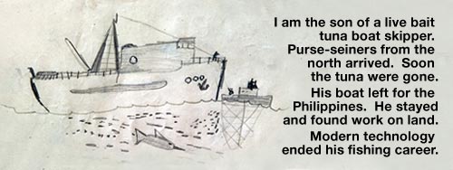
I did this drawing when I was 5 years old. My dad's tuna clipper, with a crew of twelve, could be gone for nine months and return with 120 tons of tuna. The giant fish were caught by poles with men in ocean racks off the stern. At times, three poles were connected to one line.

I am writing about human nature. And today, the drama of human nature escalates in what many know, erroneously, as the Klamath Basin crisis but which is really humans manipulating-managing Klamath River Watershed resources.

Invisible Elephants in a Porcelain Forest.

Populations! There are humans worried about the Coho salmon population. There are humans worried about the Sucker fish populations. There are humans worried about the Spotted Owl. There are some humans, usually living faraway, who worry about all of these populations. There are humans who are worried about a growing number of wildlife populations yet to make the endangered headlines. And, there are humans worried about their families, towns and ways of life..

But there is one population that goes largely unnoticed, the human population.
Without humans would there be population problems? Ask the tree falling from old age, storms, fire, ice drought or flood or… Would this tree make a sound without humans? The human is a by-product of wildlife extinction. This is not a new phenomenon. Meteorites strike the earth, super volcanos explode, ice ages come and go, predators wipe out their food supplies and perish… And on and on as our little planet, spinning in an expanding universe, hurdles through a space whose ever-increasing scale defies human comprehension.

In my lifetime the global population has doubled. Around the world one billion human are hungry and do not have access to clean water. In the United States, hospitals, schools, prisons, unemployment lines, and bankruptcy courts are overwhelmed by the masses. Addictions are increasing, kids are unhealthy, teens unsatisfied, food production challenged, and transportation- water-power delivery systems are stressed by population pressure. Cities, counties, states and the Federal government find it difficult to cover expenses. Most people would agree this is reality, it is not good and changes need to be made. They feel constraints. They see their expectations not being met. Parents realize that their children’s futures may not offer the same opportunities they had. So what are we going to do about it? Effective change begins with understanding your own watershed, not somewhere else. Rebuild the future one neighborhood’s watershed at a time.

An Unspoken Truth that Echoes Across All Habitats.

It is not fun to point a finger in another's face but when the times are necessary...

Now, here is what I have to say that many folks will not like to hear. Our economy is based on the simple premise that a increasing population, an ever-expanding consumer base, will float all boats: luxury yachts, aircraft carriers and dinghies. Tomorrow will pay for today. And so goes the human condition. And so goes the human population. We now find that today is not paying for yesterday. Some may feel that this is an unpatriotic sentiment. I argue that an expanding human population without hope poses the greatest threat to national security. This is not about government, or governments, this is about individual choices humans make. I will use less power. I will maximize my water consumption. I will eat replaceable food. I will have less children. I believe modern humans subconsciously understand population issues confront, and effect, them everywhere they go. We do know this, but…

In days of old if it became to crowded, one cross an ocean and find a new frontier.
Where do we go today? And the answer isn’t space. At the moment, we only have beds for six people orbiting earth. And what does all of this have to do with Coho salmon? It has everything to do with it.

Coho salmon populations, suckers populations, human populations… Which population has the greatest impact on the other populations? Which population needs the most help to be able to help other populations? Ask yourself a simple question, what will your neighborhood be like in twenty years? Sooner, or later, human population will be become a political issue.

This is a t-shirt that I designed in 2000 for the Bald Eagle Conference. It is now called the Winter Wings Festival. It seems folks grew weary of the Bald Eagle recovery effort.

Speaking of economies, the humans who create crisis are the humans who make money “fixing” the crisis. This leads to unintended consequences in the name of saving mother nature. Over time the greatest motivation becomes not species protection, it becomes job creation and job security in search of benevolent retirements. If you think planet Earth really cares what happens to humans try finding a dinosaur to fill out your Wednesday night poker game!

©2010 Anders Tomlinson, all rights reserved.

Next installment: Those Who Create Crisis Create Crisis.